
Registered campsite
Tourism
Tourist information
Tourist information
From our campsite you can take walks to the surroundings, with your own caravan or, if you wish, we can do it together too.
Here we present some examples of all the tourist possibilities that Ibarra and the region offer. For all destinations we provide more information with pleasure.
Yahuarcocha lagoon
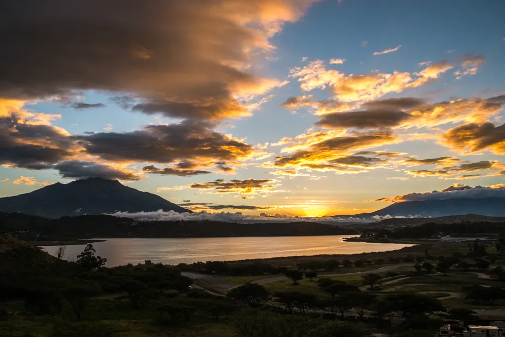
The lake next to the farm. Its Kichwa name means "lake of blood", after a battle of the Inca conquest. A racetrack runs around it, with restaurants and walks along the shore.
Photo: Philippe Stieffatre, CC BY-SA 3.0, Wikimedia Commons

Paragliders over the Yahuarcocha lagoon
At an altitude of approximately 2800 meters above sea level, several places have been provided for paragliding. The flight distance from the start to the fall is approximately 560 m. The landing strip on the shore of the lake is also marked. International paragliding championships are held several times a year in Yahuarcocha. We have a professional flight instructor, he belongs to a paragliding school and offers partner flights and accompaniment for individual flights. Information about prices and schedules can be obtained from us.
Return via Aluburo to the Chota valley
From the farm the road drops via Aloburo into the warm Chota valley, home of Afro-Ecuadorian culture and bomba music.
Photo: amalavida.tv, CC BY-SA 2.0, Wikimedia Commons

Chachimbiro volcanic thermal baths
Pools of volcanic hot spring water in Urcuquí, at the foot of the Chachimbiro volcanic complex.
Photo: Rinaldo Wurglitsch, CC BY 2.0, Wikimedia Commons

Walk to the volcanic craters of the Cuicocha or Mojanda lagoons
Cuicocha is a crater lake at the foot of Cotacachi volcano, with two islets and a trail around the rim. Mojanda is a group of páramo lakes above Otavalo.
Photo: Ymblanter, CC BY-SA 4.0, Wikimedia Commons

Walk to the city of leather production Cotacachi
The leather town: dozens of shops selling locally made jackets, bags, belts and boots.
Visit to the largest artisan market in Latin America in Otavalo
Plaza de los Ponchos, the best-known indigenous craft market in the country. Saturday is the big day.
Photo: Arabsalam, CC BY-SA 4.0, Wikimedia Commons

Hike to the Peguche waterfall including a visit to the site of indigenous cults
A waterfall in a forest next to Otavalo, a sacred site for the ritual bath before Inti Raymi.
Photo: TupakAmaruIshkay, CC BY-SA 4.0, Wikimedia Commons

Lake San Pablo
A lake at 2,660 m at the foot of Imbabura volcano, next to Otavalo, with jetties and boat trips.
Photo: David C. S., CC BY-SA 4.0, Wikimedia Commons

Ilumán
A village next to Otavalo known for its yachaks, Andean healers who cure with plants and rituals, and for its felt hats.
Photo: Diego Tirira, CC BY-SA 2.0, Wikimedia Commons

Trip to the Intag Valley
A subtropical valley west of Cotacachi: cloud forest, highland coffee and the Nangulví hot springs.
Photo: Intag Ecuador, CC BY 4.0, Wikimedia Commons

Condor Otavalo Park
Unfortunately there are not many free condors in the Andes of Ecuador. But whoever wants to see one of the most wonderful and difficult to find animals, can visit the Condor Park in Otavalo. Above the city with a great view of the volcanoes around Lake San Pablo, a beautiful park was created with many different species of birds.
More information: Parque Cóndor
Photo: Arabsalam, CC BY-SA 4.0, Wikimedia Commons

Saint Michael the Archangel viewpoint
The statue of Ibarra's patron saint on the Alto de Reyes hill, overlooking the city, Imbabura volcano and Yahuarcocha. You can climb up inside it to a small balcony.
Historic centre of Ibarra, the White City
The "White City", rebuilt after the 1868 earthquake. Start at Parque Pedro Moncayo and don't leave without trying helados de paila.
Photo: David C. S., CC BY-SA 4.0, Wikimedia Commons

Guayabillas protected forest
A 54-hectare protected forest above Ibarra, the city's green lung: trails, birds and an interpretation centre.
Photo: Hanumann, CC BY 2.0, Wikimedia Commons

San Antonio de Ibarra, the woodcarvers' village
The woodcarvers' village: more than 400 sculpture workshops, with a craft listed as Ecuadorian intangible cultural heritage in 2020.
Photo: David C. S., CC BY-SA 4.0, Wikimedia Commons

Zuleta
A community in Angochagua famous for its hand embroidery and for Hacienda Zuleta, dating from 1691, where Andean condors are rehabilitated.
Photo: Diego Tirira, CC BY-SA 2.0, Wikimedia Commons

Pyramids of Cochasquí
15 truncated pyramids and 21 pre-Inca burial mounds at 3,100 m, in an 84-hectare archaeological park.
Photo: Ymblanter, CC BY-SA 4.0, Wikimedia Commons

Frailejón forest of Mira
Frailejón forests on the páramo of Carchi, in the El Ángel Ecological Reserve. Bring warm clothes.
Photo: amalavida.tv, CC BY-SA 2.0, Wikimedia Commons

Quitsato sundial in Cayambe
A sundial 54 m across, right on the equator, seven kilometres south of Cayambe.
Photo: Ymblanter, CC BY-SA 4.0, Wikimedia Commons

The Ibarra train
Since 2025 the train runs again between Ibarra, San Antonio and Andrade Marín. Ask us for the timetable.
Photo: Anidaat, CC BY-SA 4.0, Wikimedia Commons

Atuntaqui and the Fábrica Imbabura
A textile town with factory shops. In Andrade Marín stands the Fábrica Imbabura from 1924, now a textile museum and heritage site, and the last stop of the Ibarra train.
Photo: Flipguvara, CC BY-SA 4.0, Wikimedia Commons

Request a booking
Tell us your dates and what you are looking for. We reply by email or WhatsApp.